![](/images/other/stat-length.png)
![Randonnée A pied Bad Waltersdorf - S2 Hügelland Weg - Photo](https://media.geolcdn.com/t/1900/400/44c06e8c-23ab-4301-b184-4ac3b204ecd2.jpeg&format=pjpeg&maxdim=2)
S2 Hügelland Weg
SityTrail - itinéraires balisés pédestres
Tous les sentiers balisés d’Europe GUIDE+
![Longueur](/images/other/stat-length.png)
Longueur
10,3 km
![Altitude max](https://static1.geolcdn.com/siteimages/upload/files/1508320355ic_sort_altitude_max_24dp.png)
Altitude max
440 m
![Dénivelé positif](https://static1.geolcdn.com/siteimages/upload/files/1508320355ic_sort_den_pos_24dp.png)
Dénivelé positif
227 m
![Km-Effort](/images/other/stat-length.png)
Km-Effort
13 km
![Altitude min](https://static1.geolcdn.com/siteimages/upload/files/1508320355ic_sort_altitude_min_24dp.png)
Altitude min
292 m
![Dénivelé négatif](https://static1.geolcdn.com/siteimages/upload/files/1508320355ic_sort_den_neg_24dp.png)
Dénivelé négatif
138 m
![Boucle](https://static1.geolcdn.com/siteimages/upload/files/16400158638029165_repeat_loop_refresh_sync_direction_icon.png)
Boucle
Non
Balise
Date de création :
2022-02-16 17:33:13.685
Dernière modification :
2022-03-03 21:35:41.264
![A pied](https://static1.geolcdn.com/sitytour/trail-icons/100.png)
2h57
Difficulté : Facile
![Scannez ce code QR pour ouvrir la randonnée dans l'application SityTrail](https://capi.geolives.com/qq0zvz2zws4bq2lad0pu/sitytour/trails/3129909/qr.png?size=200)
Application GPS de randonnée GRATUITE
À propos
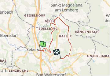
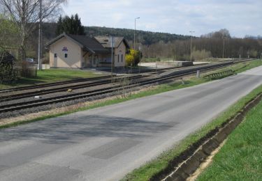
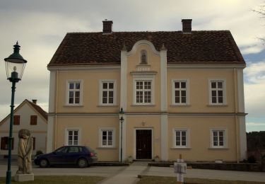
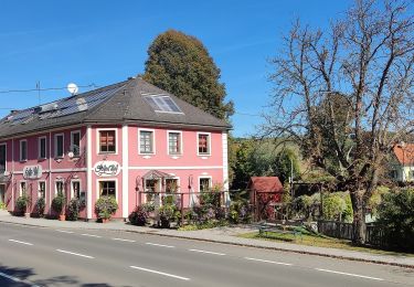
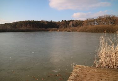
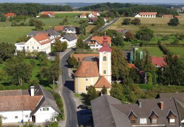
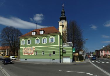
Randonnée A pied de 10,3 km à découvrir à Styrie, Bezirk Hartberg-Fürstenfeld, Bad Waltersdorf. Cette randonnée est proposée par SityTrail - itinéraires balisés pédestres.
Description
Randonnée créée par 2-Thermenregion Bad Waltersdorf.
Localisation
Pays :
Autriche
Région :
Styrie
Département/Province :
Bezirk Hartberg-Fürstenfeld
Commune :
Bad Waltersdorf
Localité :
Unknown
Départ:(Dec)
Départ:(UTM)
575387 ; 5226421 (33T) N.
Commentaires
Randonnées à proximité
![Randonnée A pied Bad Waltersdorf - S1 Berg- und Tal Rundwanderweg - Photo](https://media.geolcdn.com/t/375/260/44c06e8c-23ab-4301-b184-4ac3b204ecd2.jpeg&format=jpg&maxdim=2)
![A pied A pied](https://static1.geolcdn.com/sitytour/trail-icons/100.png)
S1 Berg- und Tal Rundwanderweg
A pied
Facile
Bad Waltersdorf,
Styrie,
Bezirk Hartberg-Fürstenfeld,
Autriche
![](/images/other/stat-length.png)
10 km | 12 km-effort
2h 43min
![](https://static1.geolcdn.com/siteimages/upload/files/16400158638029165_repeat_loop_refresh_sync_direction_icon.png)
Non
![Randonnée A pied Bad Waltersdorf - Herrschaftswaldweg (W7) - Photo](https://media.geolcdn.com/t/375/260/a53dbc2d-f6e3-46d6-a11b-08b69fe5948f.jpeg&format=jpg&maxdim=2)
![A pied A pied](https://static1.geolcdn.com/sitytour/trail-icons/100.png)
Herrschaftswaldweg (W7)
A pied
Facile
Bad Waltersdorf,
Styrie,
Bezirk Hartberg-Fürstenfeld,
Autriche
![](/images/other/stat-length.png)
8,9 km | 11,3 km-effort
2h 33min
![](https://static1.geolcdn.com/siteimages/upload/files/16400158638029165_repeat_loop_refresh_sync_direction_icon.png)
Non
![Randonnée A pied Hartl - Kneipp-Atem-Aktivweg - Photo](https://media.geolcdn.com/t/375/260/78d0f903-c348-48e7-a115-c0685911fb8b.jpeg&format=jpg&maxdim=2)
![A pied A pied](https://static1.geolcdn.com/sitytour/trail-icons/100.png)
Kneipp-Atem-Aktivweg
A pied
Facile
Hartl,
Styrie,
Bezirk Hartberg-Fürstenfeld,
Autriche
![](/images/other/stat-length.png)
5,3 km | 6,3 km-effort
1h 26min
![](https://static1.geolcdn.com/siteimages/upload/files/16400158638029165_repeat_loop_refresh_sync_direction_icon.png)
Oui
![Randonnée A pied Bad Waltersdorf - S3 Sebersdorfberg Weg - Photo](https://media.geolcdn.com/t/375/260/236c6eff-fbc3-4437-9a71-91cee705ee3f.jpeg&format=jpg&maxdim=2)
![A pied A pied](https://static1.geolcdn.com/sitytour/trail-icons/100.png)
S3 Sebersdorfberg Weg
A pied
Facile
Bad Waltersdorf,
Styrie,
Bezirk Hartberg-Fürstenfeld,
Autriche
![](/images/other/stat-length.png)
11,8 km | 15,5 km-effort
3h 31min
![](https://static1.geolcdn.com/siteimages/upload/files/16400158638029165_repeat_loop_refresh_sync_direction_icon.png)
Non
![Randonnée A pied Buch-Sankt Magdalena - M4 Fichtenbründl-Weg - Photo](https://media.geolcdn.com/t/375/260/e34e2f4b-7041-46aa-8cae-b8fa981d735f.jpeg&format=jpg&maxdim=2)
![A pied A pied](https://static1.geolcdn.com/sitytour/trail-icons/100.png)
M4 Fichtenbründl-Weg
A pied
Facile
Buch-Sankt Magdalena,
Styrie,
Bezirk Hartberg-Fürstenfeld,
Autriche
![](/images/other/stat-length.png)
10,5 km | 12,8 km-effort
2h 53min
![](https://static1.geolcdn.com/siteimages/upload/files/16400158638029165_repeat_loop_refresh_sync_direction_icon.png)
Non
![Randonnée A pied Bad Waltersdorf - Keltischer-Baumkreis-Weg (W6) - Photo](https://media.geolcdn.com/t/375/260/895527bf-7b5b-4c49-917a-9b3c648e18cf.jpeg&format=jpg&maxdim=2)
![A pied A pied](https://static1.geolcdn.com/sitytour/trail-icons/100.png)
Keltischer-Baumkreis-Weg (W6)
A pied
Facile
Bad Waltersdorf,
Styrie,
Bezirk Hartberg-Fürstenfeld,
Autriche
![](/images/other/stat-length.png)
12,3 km | 15,8 km-effort
3h 35min
![](https://static1.geolcdn.com/siteimages/upload/files/16400158638029165_repeat_loop_refresh_sync_direction_icon.png)
Non
![Randonnée A pied Hartl - Hofwald-Weg (A3) - Photo](https://media.geolcdn.com/t/375/260/3dd169dd-87fc-4c8e-a36c-1ab5e9ac15ce.jpeg&format=jpg&maxdim=2)
![A pied A pied](https://static1.geolcdn.com/sitytour/trail-icons/100.png)
Hofwald-Weg (A3)
A pied
Facile
Hartl,
Styrie,
Bezirk Hartberg-Fürstenfeld,
Autriche
![](/images/other/stat-length.png)
9,4 km | 11,5 km-effort
2h 36min
![](https://static1.geolcdn.com/siteimages/upload/files/16400158638029165_repeat_loop_refresh_sync_direction_icon.png)
Oui
![Randonnée A pied Hartl - Hohenbrugg-Weg (A4) - Photo](https://media.geolcdn.com/t/375/260/429e6ffa-caeb-4704-83cc-a60e154afd22.jpeg&format=jpg&maxdim=2)
![A pied A pied](https://static1.geolcdn.com/sitytour/trail-icons/100.png)
Hohenbrugg-Weg (A4)
A pied
Facile
Hartl,
Styrie,
Bezirk Hartberg-Fürstenfeld,
Autriche
![](/images/other/stat-length.png)
9,9 km | 11,7 km-effort
2h 39min
![](https://static1.geolcdn.com/siteimages/upload/files/16400158638029165_repeat_loop_refresh_sync_direction_icon.png)
Non
![Randonnée A pied Bad Waltersdorf - Berglerweg (W8) - Photo](https://media.geolcdn.com/t/375/260/4fd8af4d-ac29-451e-b92f-91c4c1aedab8.jpeg&format=jpg&maxdim=2)
![A pied A pied](https://static1.geolcdn.com/sitytour/trail-icons/100.png)
Berglerweg (W8)
A pied
Facile
Bad Waltersdorf,
Styrie,
Bezirk Hartberg-Fürstenfeld,
Autriche
![](/images/other/stat-length.png)
8,4 km | 10,4 km-effort
2h 22min
![](https://static1.geolcdn.com/siteimages/upload/files/16400158638029165_repeat_loop_refresh_sync_direction_icon.png)
Oui